February 2 is World Wetlands Day. This day commemorates the signing of the Convention on Wetlands of International Importance (the Ramsar Convention) in Ramsar, Iran, 49 years ago. It’s also a day set aside to raise public awareness on wetland values to promote their conservation and wise use.
Wetlands are amongst the most productive ecosystems on earth. Wetlands provide water for daily use, soils for agriculture, fish for food, pasture for cattle and materials for construction. Millions of people across the world, including Kenya, directly depend on them for their livelihoods! These unique ecosystems also provide essential services such as flood control, water filtration, protecting soil from erosion and carbon sequestration (removing carbon from the atmosphere and depositing it in a reservoir – in this case, in plants).
We dedicate this issue to highlighting some of the measures being undertaken by Nature Kenya to conserve two of the country’s most important wetlands – the Tana River Delta and Yala Swamp.
The Tana River Delta
The Tana River Delta is an unprotected wetland on the Kenyan coast. The Delta, a designated Key Biodiversity Area (KBA), covers 130,000 ha and is Kenya’s largest wetland. The Tana River Delta is also a designated Ramsar site – a recognized wetland of global importance. The Delta's abundant biodiversity is a reflection of its rich and diverse habitats which comprise of a vast patchwork of palm savannah, seasonally flooded grassland, forest fragments, acacia woodlands, lakes, marine wetlands and the river itself. The Tana River Delta is, therefore, one of the most important wetlands in Africa.
The Tana River Delta is also known for being a highly fragile and dynamic wetland system, flooding in times of good rain and drying off again. Over the years, Nature Kenya has been working with the people of the Delta, seeking to maintain a balance as any small change in the hydrological system could potentially upset the delicate natural balance, disrupting the ecosystem.
Nature Kenya is currently involved in the implementation of the Tana River Delta Land Use Plan (LUP). The LUP’s implementation process seeks to ensure that biodiversity needs are considered in the planning of development activities within the Delta. In the past, during planning processes, the intangible ecosystem services offered by the Delta were often overlooked.
The Tana Delta LUP was developed between 2011 and 2016 in a process that brought together local communities, over 18 government ministries and departments, the county governments of Tana River and Lamu, and international planning experts who offered technical assistance. The process aimed at striking a balance between human development needs and the conservation of biodiversity. A Strategic Environmental Assessment (SEA) informed the development of the Tana River Delta Land Use Plan, unlike all other planning processes previously conducted in the country.
Through a Darwin Initiative funded project, local communities, county governments of Tana River and Lamu and national government agencies with the support of Nature Kenya have identified 95,000 ha out of the 130,000 ha in the Delta for the establishment of Indigenous and Community Conserved Areas (ICCAs). As part of the implementation of the Land Use Plan, Nature Kenya is supporting the designation of ICCAs to conserve important cultural values and biodiversity and also promote ecotourism. The ICCAs will ensure that biodiversity conservation is recognized as a key use for land equal to other uses such as farming, pastoralism and fishing. Nature Kenya has also targeted the restoration of at least 10,000 ha of land to enable and foster the increased survival of biodiversity.
Currently, Nature Kenya is engaging and supporting local communities to promote sustainable crop, livestock and fish farming, ecotourism, beekeeping and other nature-based enterprises. This will complement and support the conservation of wildlife and other forms of biodiversity. All stakeholders, including the National and County government ministries and departments, community-based organizations, non-governmental organizations, local communities and private investors, are being encouraged to take action towards a sustainably managed Tana Delta. The Tana Delta Conservation Network – the Tana River Delta KBA site support group – is the taking lead in coordinating conservation activities within the community areas.
To further ensure that biodiversity conservation has support at the village level and that local communities own the process, Nature Kenya has formed Village Natural Resource and Land Use committees in all Delta villages to facilitate governance, conservation and development actions.
Yala Swamp
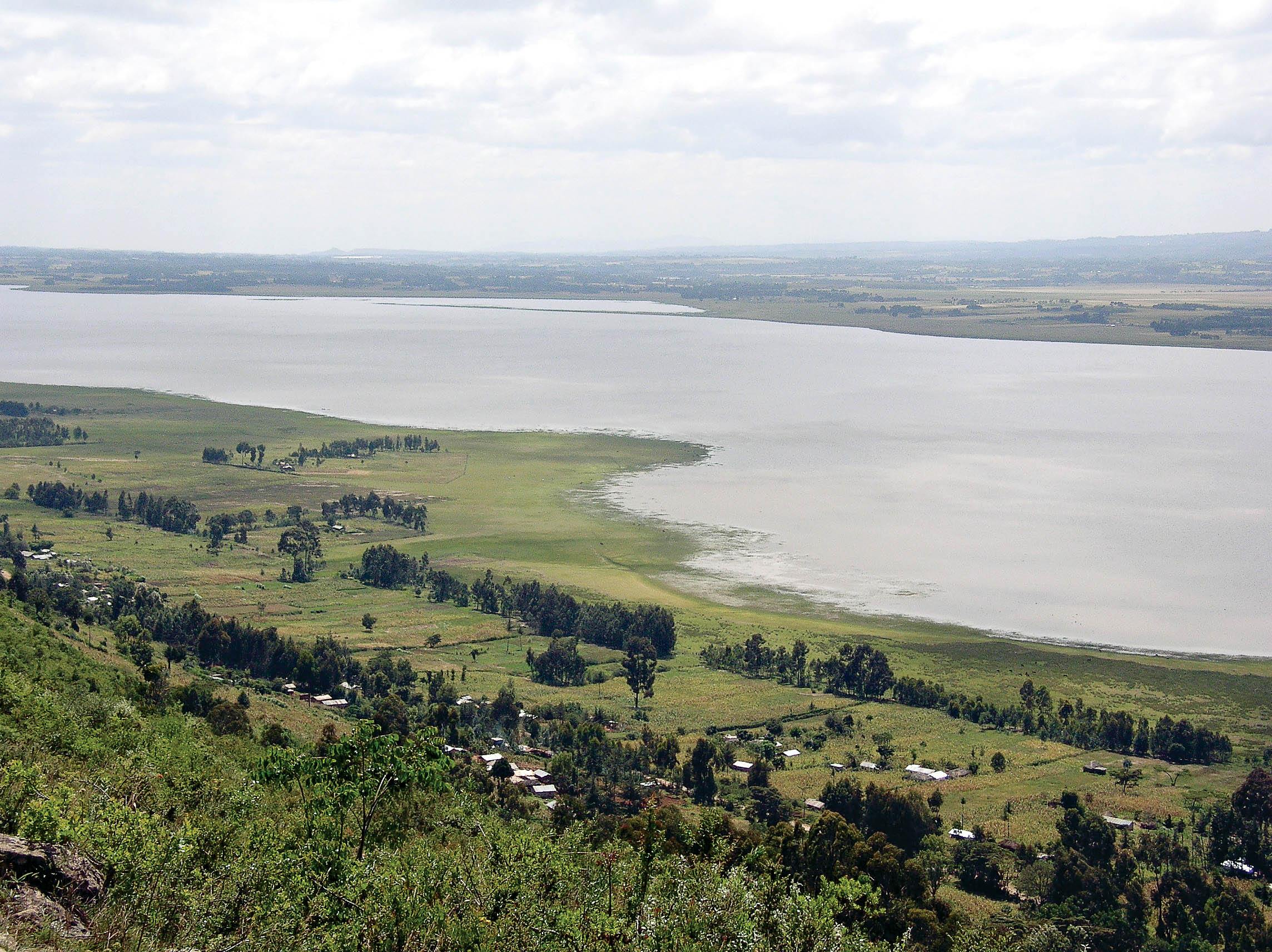
Yala swamp lies on the north-eastern shore of Lake Victoria. The swamp is Kenya’s largest freshwater wetland (the Tana Delta is both freshwater and marine), a Key Biodiversity Area and a proposed Ramsar site. Thousands of communities depend on the wetland for fishing and farming as core backbone livelihood activities.
The wetland, however, faces a myriad threats. Over-exploitation of its natural resources is one major threat. Others are encroachment, habitat degradation and biodiversity loss. Through a multi-stakeholder approach, Nature Kenya worked with local communities and the Siaya and Busia county governments to develop a Land Use Plan to balance the various interests within the wetland. This plan has been endorsed by H.E. Cornel Rasanga, Governor Siaya County, H.E. Sospeter Ojaamong’, Governor Busia County and H.E. The Rt. Hon. Raila Odinga, Prime Minister, Republic of Kenya (2008-2013) and African Union High Representative for Infrastructure Development.
Nature Kenya, through funding from the Darwin Initiative, is now keen on supporting the adoption and implementation of the Land Use Plan to ensure development overall is sustainable and compatible with biodiversity protection. As part of the implementation of the Land Use Plan, Nature Kenya is supporting the designation of ICCAs to conserve important cultural values and biodiversity and also promote ecotourism. Initial sensitization meetings with the national and county administration are on-going, spearheaded by the Yala Ecosystem Site Support Group (the Yala Swamp KBA site support group). Awareness creation meetings on ICCAs will culminate into the formation of village-level Natural Resource and Land Use Committees. The Land Use committees will be supported to deliver ICCA conservation actions on the ground. The Land Use committees will also be an integral part of the ICCA governance structure.

